
Chiapas
is the southernmost state of Mexico, located towards the southeast of the country. Chiapas is bordered by the states of Tabasco to the north, Veracruz to the northwest, and Oaxaca to the west. To the east Chiapas borders Guatemala Pacific Ocean, and to the south the Pacific Ocean.In general Chiapas has a humid, tropical climate. In the north, in the area bordering Tabasco, near Teapa, rainfall can average more than 3000 mm (120 in) per year. In the past, natural vegetation at this region was lowland, tall perennial rainforest, but this vegetation has been destroyed almost completely to give way to agriculture and ranching. Rainfall decreases moving towards the Pacific Ocean, but it is still abundant enough to allow the farming of bananas and many other tropical crops near Tapachula. On the several parallel "sierras" or mountain ranges running along the center of Chiapas, climate can be quite temperate and foggy, allowing the development of cloud forests like those of the Reserva de la Biosfera el Triunfo, home to a handful of quetzals and horned guans.
The state capital city is Tuxtla Gutierrez; other cities and towns in Chiapas include San Cristobal de las Casas, Comiton, and Tapachula. Chiapas is home to the ancient Maya ruins of Palenque, Yaxchilan, Bonampak, Chinkultic, and Tonina.
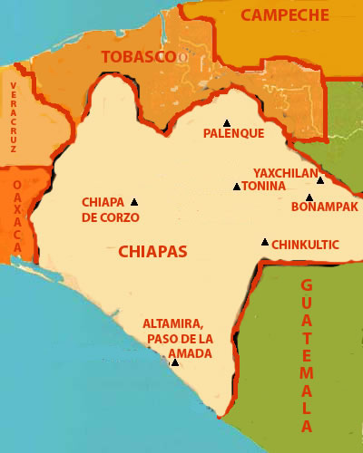
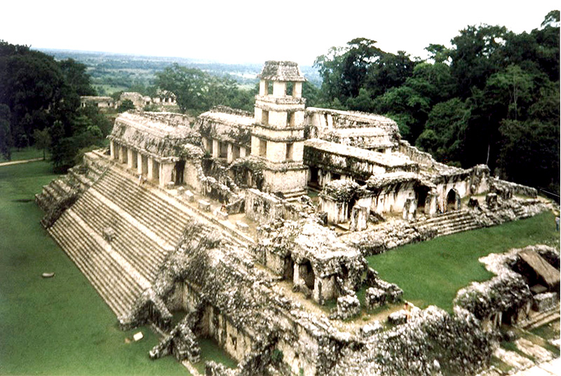
Palenque sits proudly in Palenque National Park in the state of Chiapas and is easiest reached from Villahermosa, Tabasco which is about 120 kilometers away. The modern town of Palenque has many travel
Learn More
Yaxchilan means "green stones" in Mayan. The ruins lie on the left bank of the Usumacinta River just a little north and east of the ruins of Bonampak.
Learn More
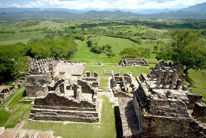
Toniná is a site constructed on a huge mountain that offers a great view of the four corners of the world. The ruins are located
Learn More
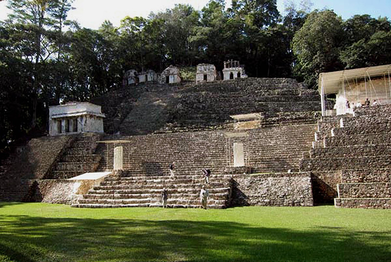
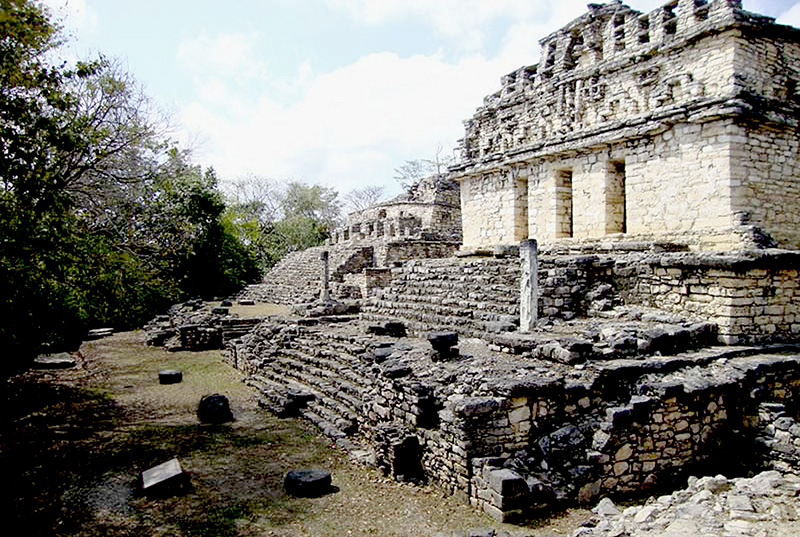
Bonampak is reachable by vehicle from Palenque. The trip is about 100 kilometers of sometimes very slow and arduous driving. Bonampak was a very large city
Learn More

Chinkultic is located about 100 kilometers from the town of San Cristobal de las Casas in Chiapas near the border with Guatemala. The site is on the edge of a large lake
Learn More
Chiapa de Corzo at its height during the Late Formative period, was a regional center or capital of the area and controlled trading routes through the Grijalva river valley.
Learn More
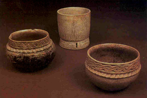
Altamira, Paso de la Amada, was a small village in the lagoon-estuary zone of the Pacific Coast. Mokaya pottery appeared first at Altamira.
Learn More

In pre-Columbian times before the Conquerors' arrival, Zinacantan already had strong links with the Aztecs in the Central Zone of Mexico.
Learn More