
Guatemala,
Republica de Guatemala is a country in Central America bordered by Mexico to the north and west, the Pacific Ocean to the southwest, Belize and the Caribbean to the northeast, and Honduras and El Salvador to the southeast.
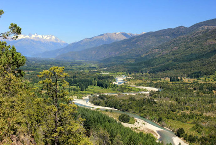
A representative democracy, its capital is Guatemala City. The nation has been stable since 1996 and has been in a state of continuous development and economic growth. Guatemala's abundance of biologically significant and unique ecosystems contribute to Mesoamerica's designation as a biodiversity hotspot.
The first evidence of human settlers in Guatemala goes back to at least 12,000 B.C.E. There is some evidence that may put this date as early as 18,000 B.C.E., such as obsidian arrow heads found in various parts of the country. There is archaeological proof that early Guatemalan settlers were hunters and gatherers, but pollen samples from Peten and the Pacific coast indicate that maize cultivation was developed by 3500 B.C.E.. Archaic sites have been documented in Quiche in the Highlands and Sipacate, Escuintla on the central Pacific coast 6500 B.C.E..
Archaeologists divide the pre-Columbian history of Mesoamerica into 3 periods: the Pre-Classic from 2000 B.C.E. to 250 C.E., the Classic from 250 to 900 C.E., and the Classic from 900 to 1500 C.E.. Until recently, the Pre-Classic was regarded as a formative period, with small villages of farmers who lived in huts, and few permanent buildings, but this notion has been challenged by recent discoveries of monumental architecture from that period.
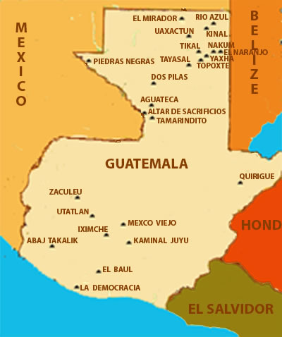
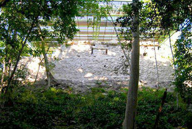
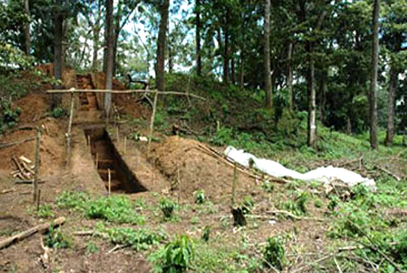
El Mirador is located just north of Tikal on the Mexico - Guatemala border. The name means "the lookout or observatory" in Spanish.
Learn More
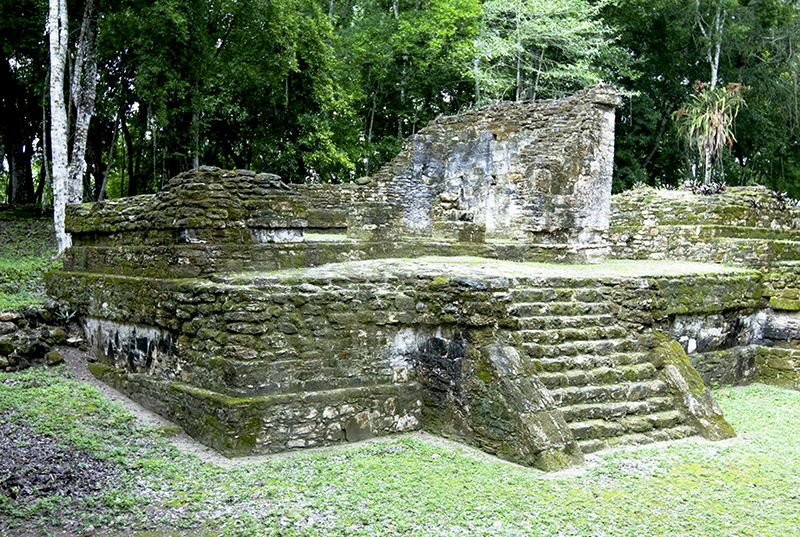
Rio Azul is a site of the Pre-Columbian Maya civilization in what is now Guatemala. Sak Ha Witznal (Clear Water Mountain) is its real name and is located 80 km north-east of Tikal. The Rio Azul National Park has several sites the most important is Rio Azul, a Major late pre-classic to early classic site, along the Rio Azul banks. Dams, canals, agricultural terraces and fortifications are distributed along the shores of this river.
Learn More
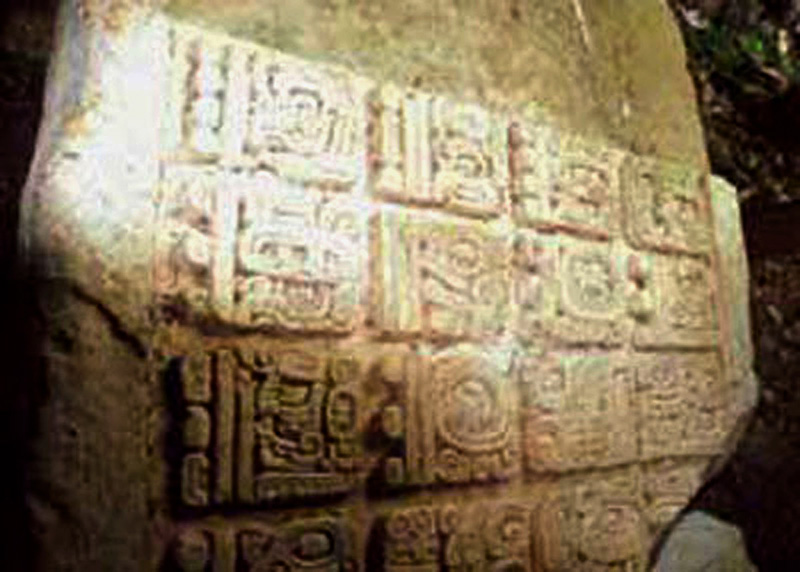
Uaxactún means "eight stones" in Mayan. The site gets its name from the fact that Sylvanus G. Morley discovered a stela with a date beginning with the number eight there.
Learn More
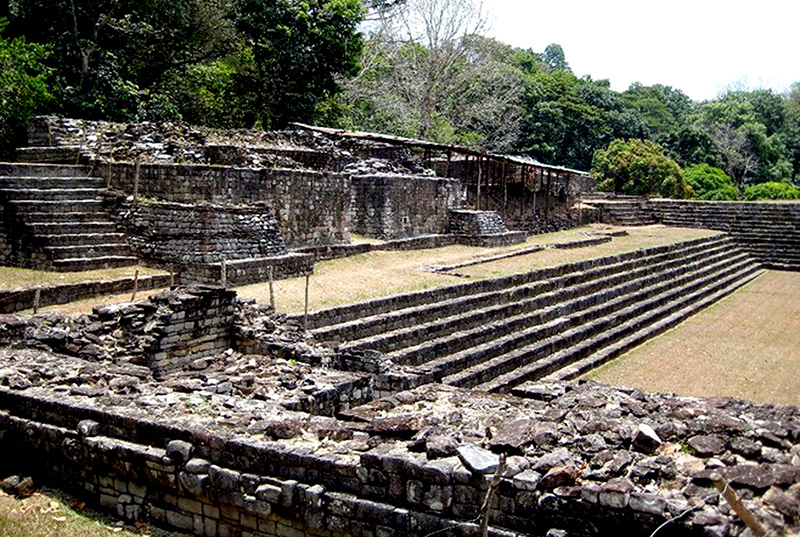
Kinal is located 9 km south west of Rio Azul in the Peten Basin region of Guatemala. The site of Kinal (Place of the Sacred Fire) dates from the Classic period of Mesoamerican chronology (c. 600 - 900 C.E.), with evidence for a substantial and expansionary building program dating from the first half of the 8th century C.E.
Learn More
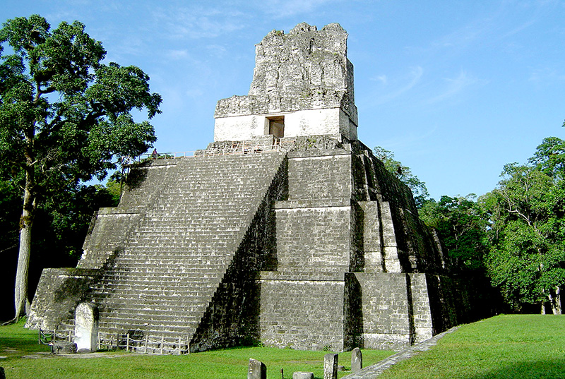
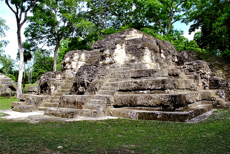
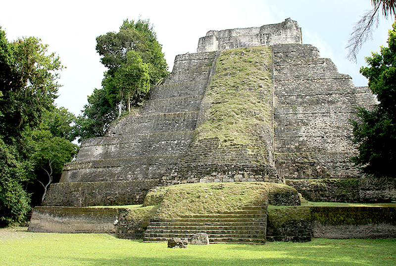
Tikal at its peak some 1,500 years ago, was home to an estimated 100,000 Maya and it was one of the more important urban center of its time.
Learn More
Nakum was first settled during the Middle Preclassic. This period saw the construction of the first versions of several important complexes and buildings. The site saw significant development during the Late Preclassic when all existing structures were rebuilt and new constructions were added.
Learn More
El Naranjo is an ancient city of the Maya civilization in the Peten Basin region of the central Mayan lowlands. It is located in the present-day department of Peten, Guatemala about 10 km west of the border with Belize. It was the capital of the Classic Mayan kingdom of Saal The ancient Classic Mayan language name for the city was Wak Kab'nal and Maxam.
Learn More
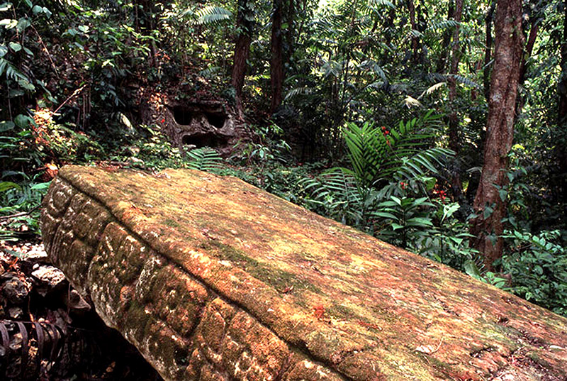
Piedras Negras means "Black Rocks" in Spanish and takes its name from the color of the stones in the river. Piedras Negras is in the most remote part of Guatemala
Learn More
Tayasal is a pre-Columbian Maya archaeological site that dates to the Postclassic period. The site is located in the southern Maya lowlands on a small island in Lake Peten Itza, now part of the Department of Peten in northern Guatemala.
Learn More
Yaxha the Temple K is being restored here, at the entrance of the site. The city has 3 main groups, the East Acropolis built on an elevated platform,
Learn More
Topoxte is located in what is now Department of Peten in northern Guatemala. As the capital of the Ko'woj Maya, it was the largest of the few Postclassic Mesoamerican sites in the area. Topoxte was located on a former island, now a peninsula,
Learn More
Dos Pilas - Means "Two Pools" in Spanish and was named after two springs near the ruins that look a bit like water tanks. The ruins lie about 10 miles southwest of Sayaxché in the Rio de la Pasion region.
Learn More
Aguateca is a Maya site located in northern Guatemala's Petexbatun Basin, in the department of Peten. The first settlements at Aguateca date to the late Preclassic period (B.C.E. 300 - C.E. 350), and the city was sacked and abandoned in the early 9th century.
Learn More
Altar de Sacrificios is located west of Seibal, very near the Rio Usumacinta River, on the Mexican border by Chiapas. 'Altar' is a relatively small site when compared with the larger ceremonial centers in the surrounding area.
Learn More
Quirigua is an ancient Maya site in the Izabal department of Guatemala. A medium sized site along the lower Motagua river, with the ceremonial center, heart of the site about 1 km from the left bank of the river.
Learn More
Zaculeu, traditional spelling, Saqulew modern Maya spelling, is a Pre-Columbian archeological site in the highlands of southwestern Guatemala, a short distance outside of the city of Huehuetenango. Zaculeu was the capital of the Postclassic Mam kingdom, a sub-group of the Maya.
Learn More
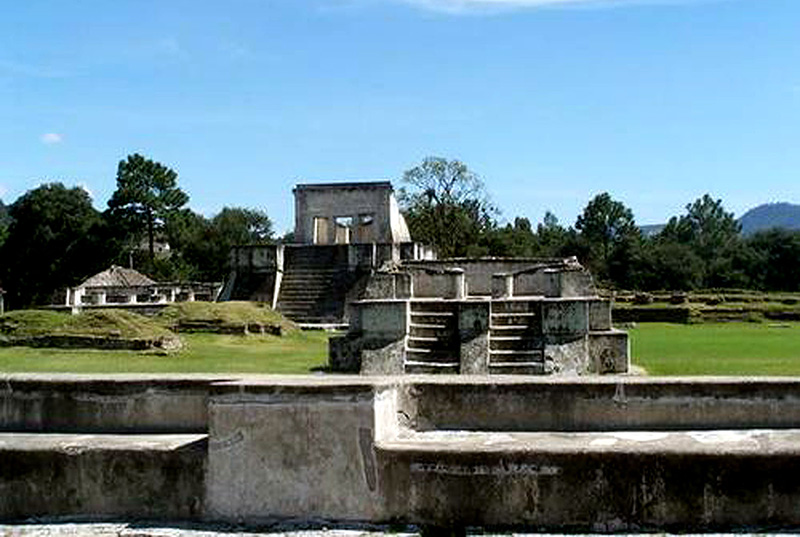
Gumarcaj, sometimes rendered as Cumarcaj or Kumarcaaj is an archeological site in El Quiche department of Guatemala. Gumarcaj is also known as Utatlan, the Nahuatl language name for the city. The name comes from K'iche' Q'umarkah "Place of old reeds".
Learn More
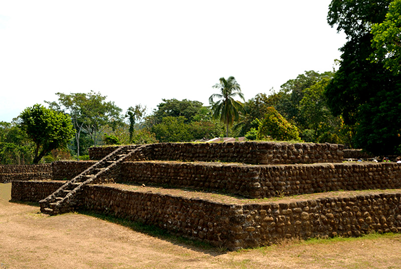
Tak'alik A'baj' formerly known as Abaj Takalik, is one of several Mesoamerican sites with both Olmec and Maya features. The site flourished in the Pre-Classic era, from the 8th century B.C.E.through the 9th century C.E.
Learn More
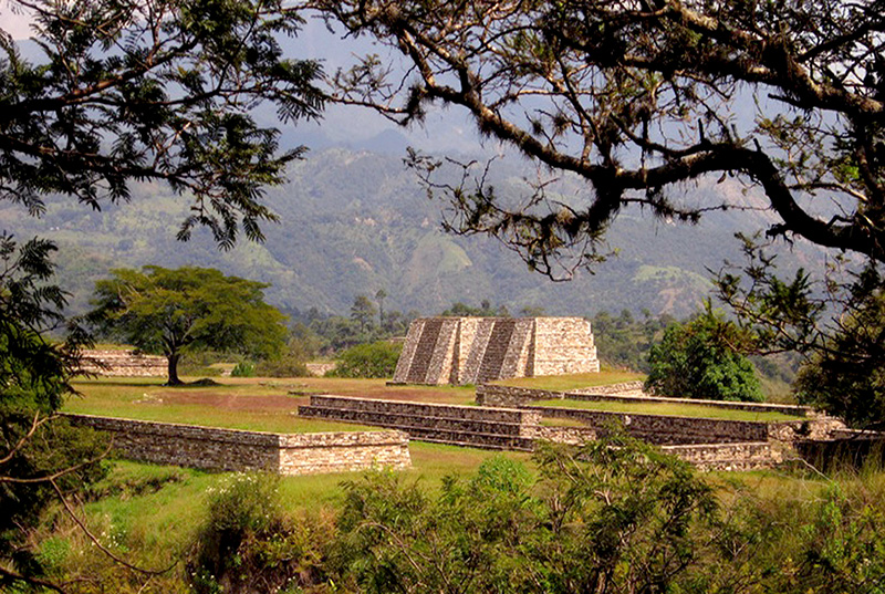
Iximche is located a mile away from Tecpan which is about 21 miles from Chimaltenango. Iximche was the capital of the Cakchiquel Maya.
Learn More
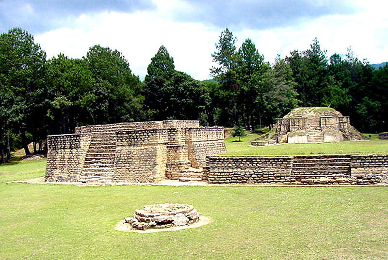
Mixco Viejo is a Mayan site in the north east of the Chimaltenango department of Guatemala, some 50 km to the north of Guatemala City and 4km from the junction of the rivers Pixcaya and Montagua. It is a moderate sized city of the Post-Classic Era.
Learn More
Kaminal Juyu has been described as one of the greatest of all archaeological sites in the New World by Michael Coe, although its remains today a few mounds only, are far less impressive than other Mayan sites more frequented by tourists.
Learn More
El Baul is a Pre-Columbian archaeological site in present-day Guatemala. El Baul, along with the sites of Bilbao and El Castillo, is part of the Cotzumalhuapa Nuclear Zone.
Learn More
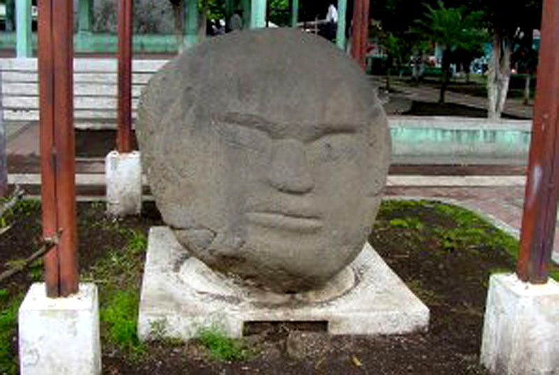
The site of La Democracia is situated in the de Escuinto department, on the Pacific coast of Guatemala. For many years archaeologists believed the Olmecs, who thrived in the Gulf of Mexico region, were the oldest American civilization.
Learn More
The site of Izapa is located on the Guatemala - Chiapas border just south of the Volcano Tacana near the city of Tapachula. Izapa is also very close to the Pacific Ocean.
Learn More