
Oaxaca,
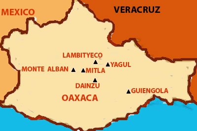
The Free and Sovereign State of Oaxaca (Estado Libre y Soberano de Oaxaca) in Spanish phonemically /oa'xaka/, named for its largest city, is one of the 31 states of Mexico, located in the southern part of the country, west of the Isthmus of Tehuantepec. Oaxaca borders the states of Guerrero to the west, Puebla to the northwest, Veracruz to the north, Chiapas to the east, and the Pacific Ocean in the south.
Oaxaca, the historic home of the Zapotec and Mixtec peoples, contains more speakers of indigenous languages than any other Mexican state.Oaxaca's rugged terrain, which caused various groups to develop in relative isolation from one another, is responsible for the cultural and linguistic diversity of the region. The central Valley of Oaxaca was one of the most fertile areas of the Americas and allowed powerful and influential groups to emerge. The valley was first occupied by the Zapotec people, who were conquered by the Mixtecs in the thirteenth century. Society was mainly organized in villages by extended family groups with communal authority, although the civilizations of the Mixtecs and Zapotecs did have kings and religious orders.
Among these civilizations' accomplishments were the domestication of many plants and animals including corn, beans, chocolate, tomatoes, chiles, squash, pumpkin, and turkeys. Also available in the fertile region of Oaxaca were pineapples, avocados, zapotes, and maguey. In the south, the Pacific Ocean was an important food source. The civilizations built by these groups are reflected in important archaeological sites including Monte Albán, Mitla, Guiengola and Huijatzoo. Monte Albán was a great ceremonial center built on a flattened mountain top by the Zapotec people which reached its zenith between 600 and 900 AD The ancient Zapotec village of Teotitlan del Valle near the city of Oaxaca is one of the oldest human settlements in Mexico.
Throughout the Zapoteca era, local and regional trade flourished, and most important economic activities were agriculture, hunting, fishing and mining; silver and gold having been fashioned by artisans for hundreds of years. Commercial routes passed through Oaxaca to the Mayan lands of the north and south to Central and South America. Major ports were located in present-day Salina Cruz, Astata, Huatulco, Puerto Angel and Pinotepa Nacional.
In the mid-fifteenth century, the central valley was conquered by the Aztecs, who forced the surrounding Mixtec and Zapotec kingdoms to pay tribute to the emperor in the Aztec capital, Tenochtitlan. The Aztec presence had the effect of increasing social and economic ties between Oaxaca and the Aztec heartland. Shortly after 1496, the Aztecs established a garrison in the center of the valley, around the Cerro del Fortun and down to the present Church of Carmen Alto where their temple was located. The Aztecs called their garrison Hueexyacac, meaning "place of guaje trees" in the Nahuatl language, named for the great number of the species (Leucaena esculenta) in the area. Under Spanish rule, Huexyacac would become Oaxaca, and the pronunciation of the x would transition from "sh" to the modern Spanish
Tenochtitlan fell to the Spanish in August of 1521 and with it all of the Aztec empire. On November 25, 1521, Francisco de Orozco arrived in the central valley to claim it in the name of the conquistador Hernan Cortes, who had been granted Oaxaca as his prize for the conquering of New Spain by the Spanish crown.
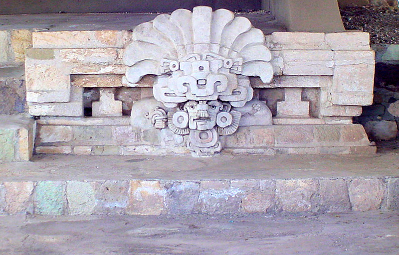
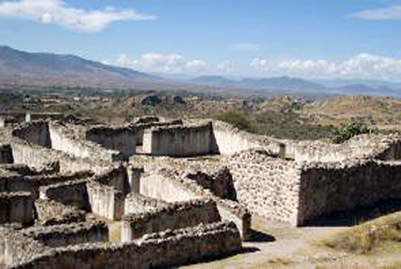
Lambityeco Lambityeco is a Zapotec name that translates as "Still" and "Mound". "Lambi" is the Zapotec version of the word alambique (still)
Learn More

Monte Alban was the ancient capital of the Zapotecs and one of the first cities in Mesoamerica. During it's epoch, it was one of the most populated. It was founded approximately 500 BC and flourished until 750 AD. Located in the central valley of Oaxaca,
Learn More
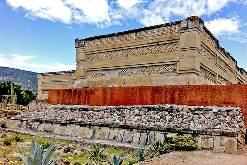
Milta was the second most important ceremonial center after Monte Alban. The name Mitla or Mictlan is of Nahuatl origin and means "Place of the Dead" or "Inframundo". In Zapotec it is called "Lyobaa",
Learn More
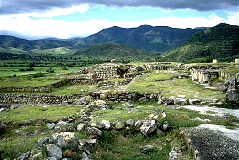
Evidence suggest that Yugal was settled in the begining of the Monte Alban 1 Period 500 B.C.E. It flourished as an urban center after Monte Alban was abandoned 800 C.E..
Learn More
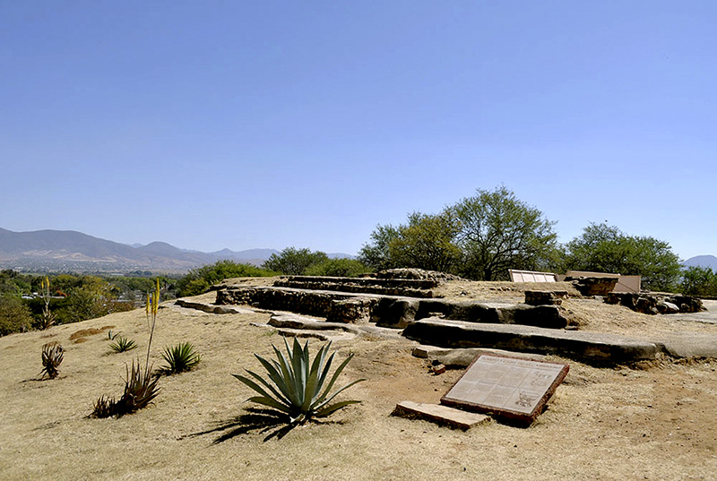
Dainzu from its beginning, during the Middle Pre-Classic Period 600 B.C.E. to end of its time 250 C.E., the site registered a great population and constructive growth.
Learn More
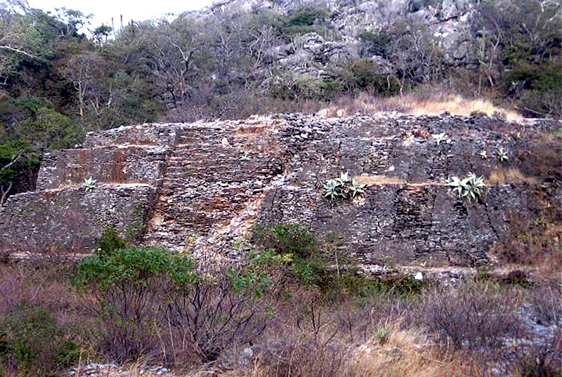
Guiengola is a Zapotec archeological site located 14 km north of Tehuantepec, and 243 km southeast of Oaxaca city on Federal Highway 190. The visible ruins are located between a hill and a river
Learn More
Zaachila was the last of the Zapotec capital following the fall of Monte Alban. The site flourished from 1100-1521 C.E.. Toward the end, Zaachila was conquered by Mixtecs,
Learn More